Panarea — Punta del Corvo
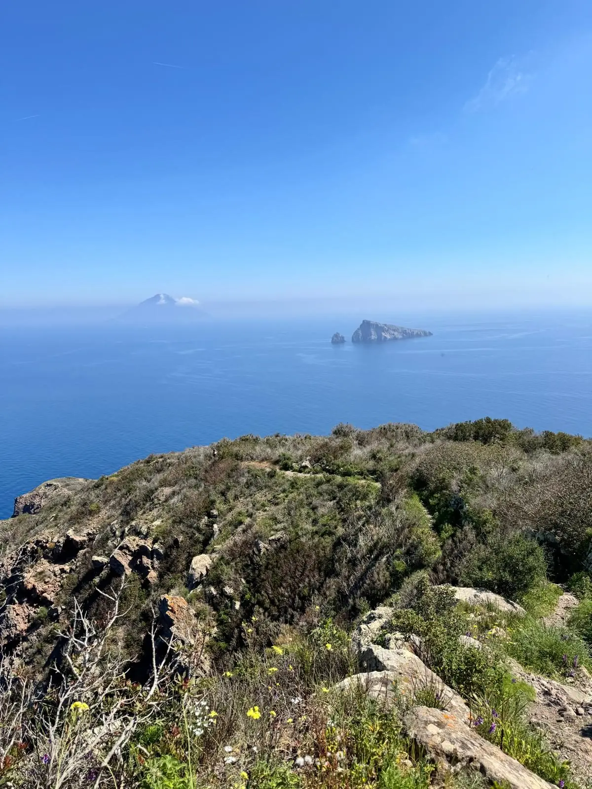
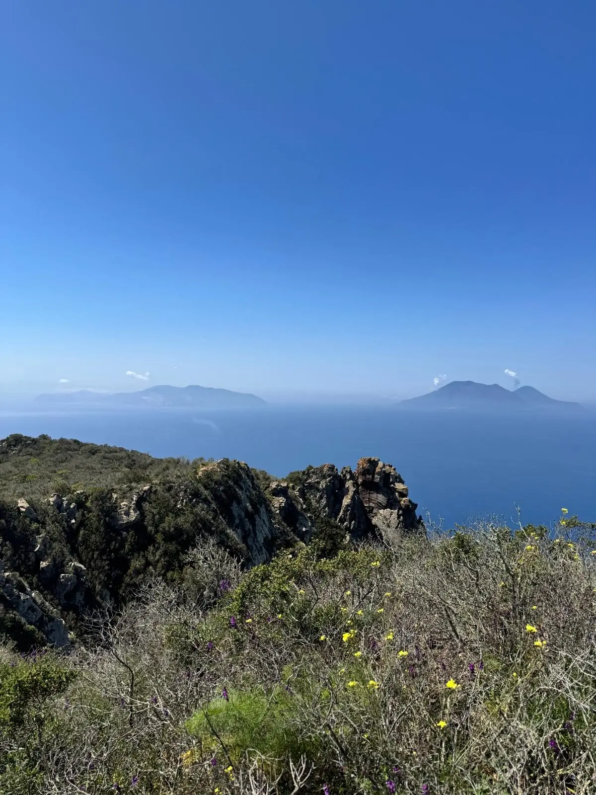
Anyone who writes Panarea off as an island of aperitifs has never set foot on the summit trail: from up there you see Basiluzzo and the cone of Stromboli on one side, Salina, Lipari and the plume of Vulcano's crater on the other.
- Difficulty
- Moderate
- Duration
- 2 h 30 walking, 4 with stops
- Elevation gain
- 714 m on the full loop
- Altitude
- 421 m
- Season
- April–June, September–October
The loop, not just the summit
Most guides describe the there-and-back climb from San Pietro. The best way to take Panarea, though, is the full loop: start at Ditella, climb the western flank, cross the summit and drop south towards Drauto and Cala Junco, coming back into the village. These are the real numbers, measured on our own April outing: 7.72 kilometres, 714 metres of ascent, two and a half hours of actual walking — which, with stops, photographs and the descent to Cala Junco, becomes a whole morning. The apparent paradox is those seven hundred metres of climbing on an island barely four hundred high: the ridge goes up and down continuously, and it adds up.
How high the summit really is
Punta del Corvo is the highest point on Panarea, and the figure you read almost everywhere is 421 metres. Sources don't agree, though: some hiking accounts give 418 metres. Three metres won't change your day, but we'd rather say so than choose. What matters is something else: Panarea is the lowest and smallest of the seven islands, and this modest summit gives a view the higher Aeolian peaks don't have, because it sits exactly in the middle.
What you see from up there
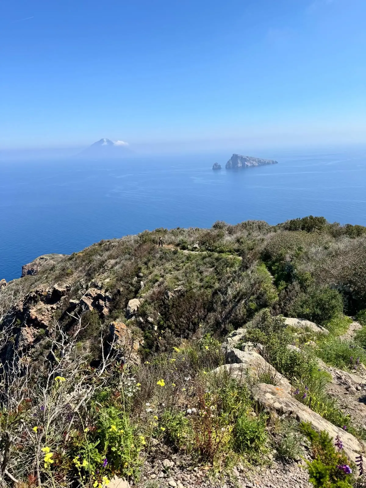
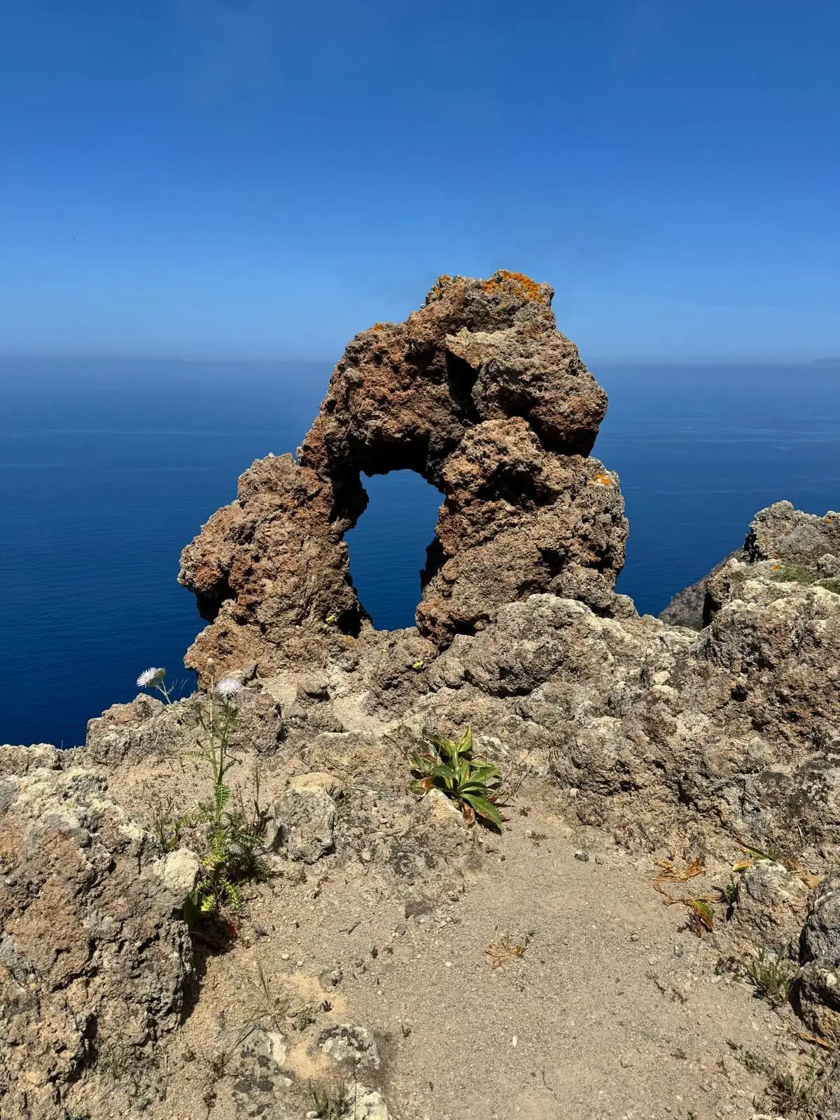
Looking north-east is the picture that earns the climb: the tabular shape of Basiluzzo resting on the water and, behind it, the cone of Stromboli under its cap of cloud. Turning south-west, Salina opens up with its twin peaks, then Lipari and Vulcano — on clear days you can make out the white plume rising from the Gran Cratere. Below, Panarea's micro-archipelago in full: Basiluzzo, Spinazzola, Dattilo, Lisca Bianca, Bottaro, Lisca Nera and the stacks of the Panarelli and the Formiche. Along the ridge you also come across an arch of volcanic rock open to the sea, which nobody signposts and where everybody stops.
It's the oldest of the Aeolians
It sounds like a detail for geologists, and instead it explains the shape of the island. Panarea is the oldest of the archipelago: what you walk on is what remains of an old volcanic complex almost entirely submerged, and the islets around it aren't scattered rocks but the emerged pieces of the same edifice. That's why the sea here is shallow and green between one island and the next: you're sailing over the crater. And the island is dormant, not extinct: on the beach at Calcara, steam fumaroles still vent at up to a hundred degrees.
The Bronze Age village above Cala Junco
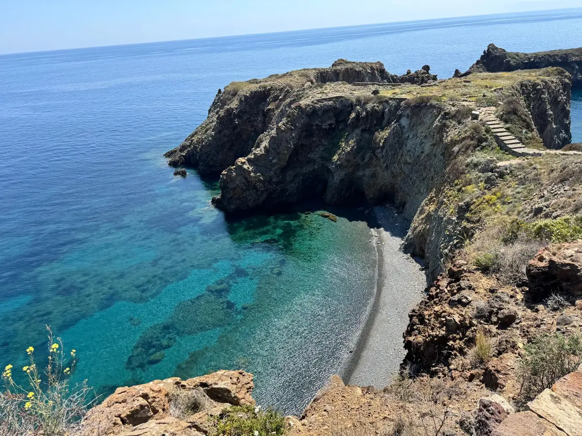
The descent south passes the part of Panarea nobody expects. On the promontory of Capo Milazzese, on a plateau sheer above the sea, lie the remains of a Bronze Age village from the 14th century BC: oval huts whose walls are still readable, and among the finds pottery of Mycenaean origin — proof that three and a half thousand years ago this cliff sat on a Mediterranean trade route. Sources diverge on the number of huts: Wikipedia says around twenty, the Aeolian tourist portal twenty-three oval ones plus a rectangular one. Below the village opens Cala Junco, the bay whose water runs from emerald to deep blue, closed off by a rock pinnacle they call the Castello del Salvamento: people sheltered there when the pirates came.
The trail, and the things nobody mentions
You climb mule tracks and flights of steps between dry-stone walls, then the way narrows into open trail through the maquis. It's marked, but the steps are high and steep and in places the path is narrow, with tall grass at summer's end: long trousers, not shorts. Shade: almost none. There is no cover on the ridge, and nothing along the way — no fountain, no bar. Two litres of water each, a hat, and if you come down late in the afternoon a light headlamp: the last stretches between the dry-stone walls and the tall scrub darken fast. There are no cars on the island: whatever you leave at the harbour, you walk back for.
When to go
April to June, then September and October. The photographs on this page were taken in mid-April: the island in flower, the path clear, the houses still shuttered and nobody on the ridge. In July and August the climb in the middle of the day is to be avoided: no shade, radiating rock, and the rest of the island full. If you're here in high summer, leave at dawn and be on top before nine.
Frequently asked questions
How long is the Panarea loop over Punta del Corvo?
The full island loop over the summit measures 7.72 kilometres with 714 metres of ascent, and takes about two and a half hours of actual walking: with stops, photographs and the descent to Cala Junco it becomes a whole morning. The simple there-and-back from San Pietro is shorter: about two and a half hours including stops.
How high is Punta del Corvo?
It is the highest point on Panarea. The figure given almost everywhere is 421 metres, but some hiking accounts report 418 metres: sources don't agree on those three metres. Panarea remains the lowest and smallest of the seven Aeolian islands.
What can you see from the summit of Panarea?
To the north-east, Basiluzzo and the cone of Stromboli; to the south-west, Salina with its twin peaks, Lipari and Vulcano, whose Gran Cratere plume is visible on clear days. Below lie all the islets of the micro-archipelago: Basiluzzo, Spinazzola, Dattilo, Lisca Bianca, Bottaro, Lisca Nera and the stacks of the Panarelli and the Formiche.
What is the prehistoric village at Cala Junco?
It is a Bronze Age settlement from the 14th century BC on the promontory of Capo Milazzese, with the remains of oval huts overlooking a sheer drop to the sea. Among the finds is pottery of Mycenaean origin, a sign that the island lay on a Mediterranean trade route. Sources diverge on the exact number of huts, between around twenty and twenty-four.
Is the trail to Punta del Corvo difficult?
It is of medium difficulty and should be taken seriously: high, steep steps, narrow sections with tall grass at summer's end, and almost no shade along the route. You need hiking shoes, long trousers, a hat and at least two litres of water each, because there is nothing along the way.
When is the best time to climb Punta del Corvo?
April to June, then September and October. In spring the island is in flower and the path is clear; in July and August the climb in the middle of the day is inadvisable because there is no shade at all, and it's better to set off at dawn.
Leaving early
Panarea in a day holds up, but only just.
The climb has to be done early, and the last hydrofoil doesn't wait. Early breakfast and a port 45 minutes away: the margin is what we give you.
Direct booking, no intermediaries · See the rooftop →